I was up and out of my motel by 6:15am, without coffee I’m afraid, but I couldn’t be bothered to wait around when there are sights to be seen and roads to be traveled!
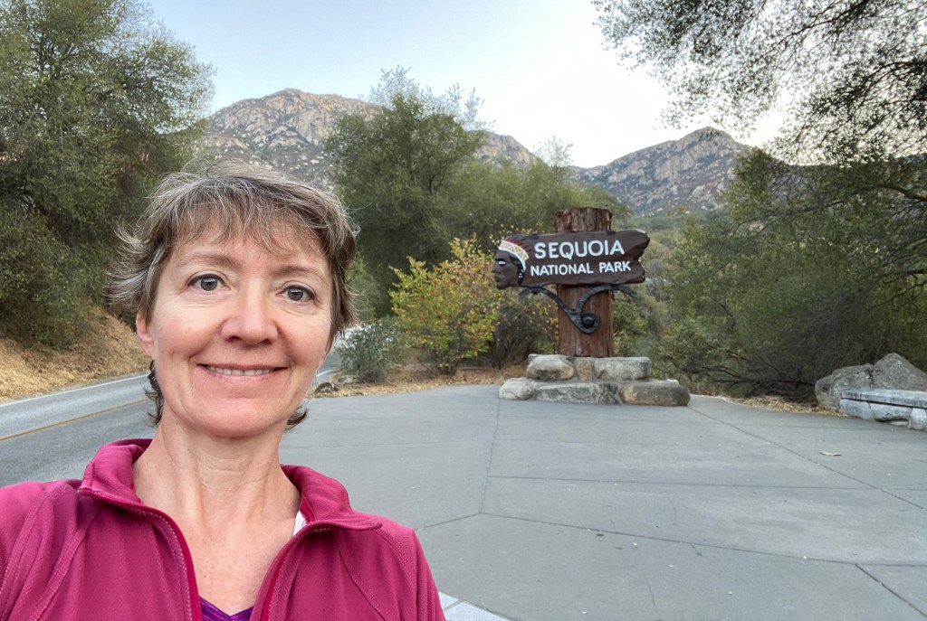
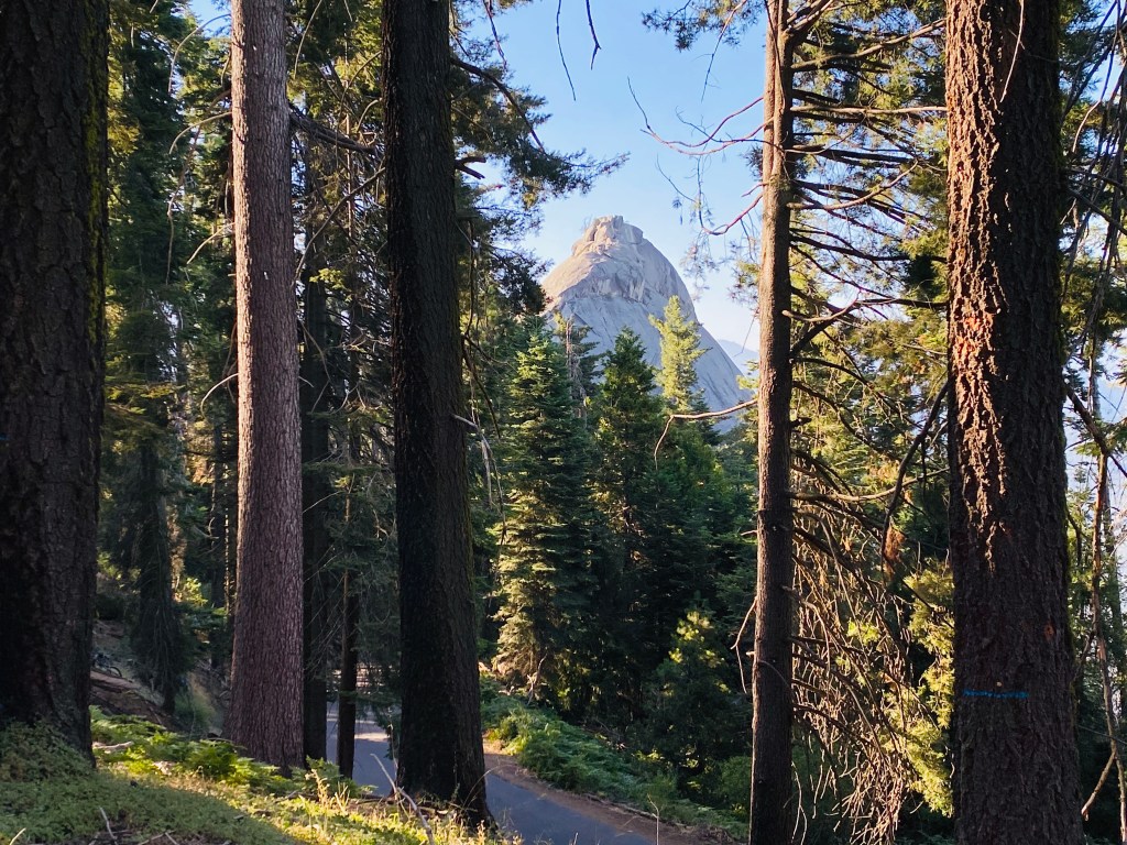
The gates to Sequoia National Park were wide open when I arrived so I drove right in and immediately started up the serpentine road that climbs up 5000’ in a series of short switchbacks till it levels out at the Moro Rock trailhead. This monolith looms over the ride up like a fierce sentinel, and I’d read that walking out to it’s edge is a Thing To Do.

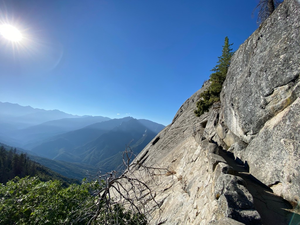
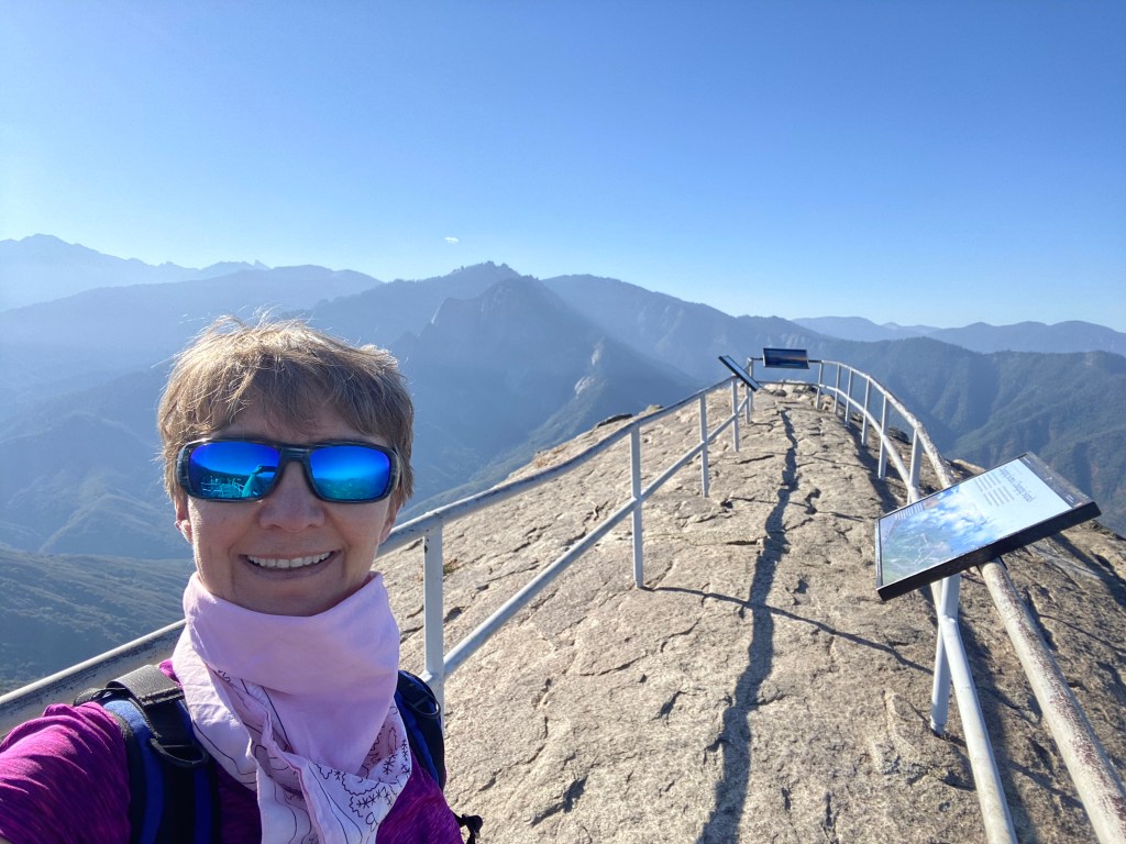
Rather than drive (because I didn’t know you could!) I walked the 2 miles through amazing forest to the start of the climb, then a 1/4 mile up 350 hand-hewn concrete stairs on the rock’s edge to reach the summit. Whew! Ideally one could look left and see Whitney and the other mountains in the Sierra range and look right to see far down into the San Joaquin valley but the air was hazy from pollution and ozone so the view was limited. I took a little detour on the return to see the Roosevelt tree, and other amazing sequoias.
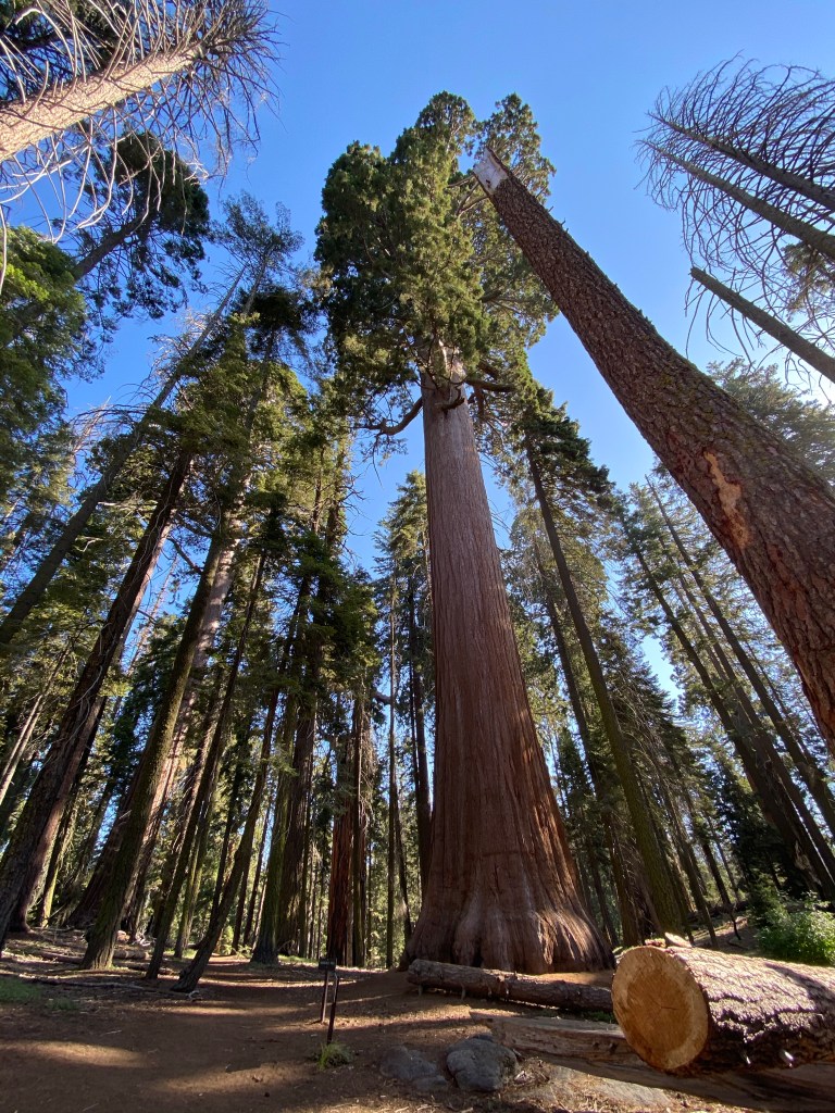
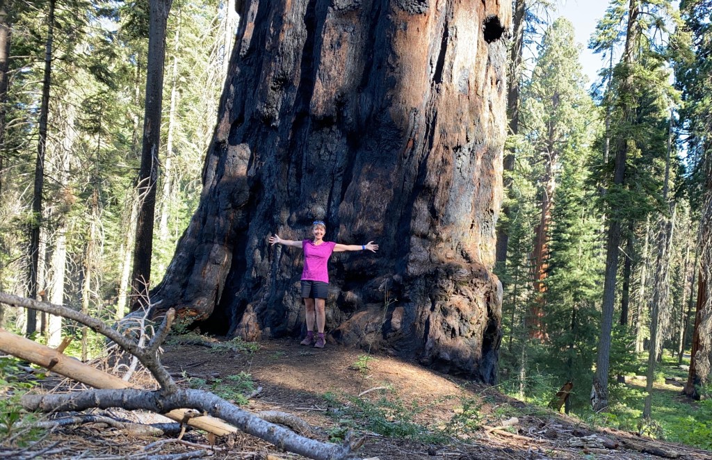
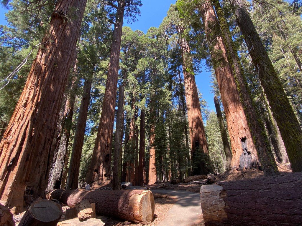
But these were nothing compared to Giant’s Forest, a few miles further along General’s Highway and home to the famous General Sherman, the largest (by volume) known sequoia! It’s diameter is a whopping 109’, and although is a rather puny 275’ high, this still makes it the biggest. And it’s still growing! It’s crown is dead but each year it keeps getting wider….
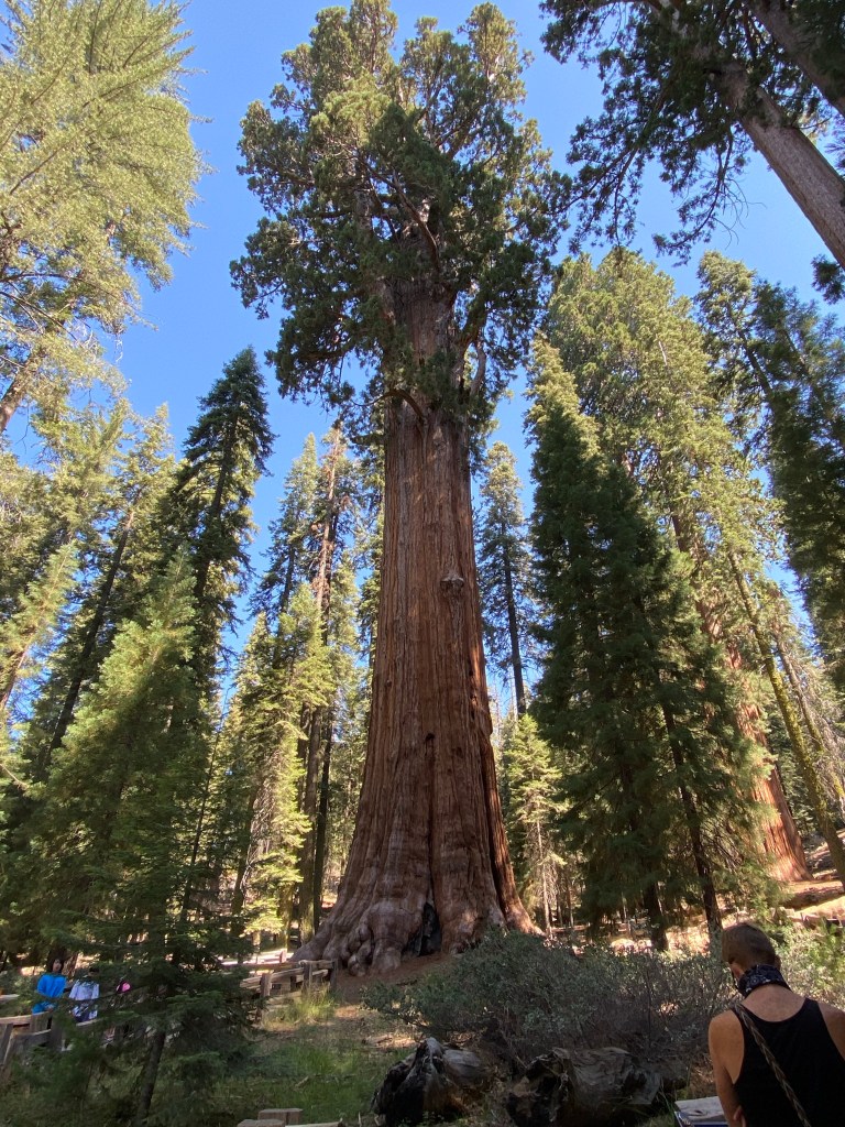
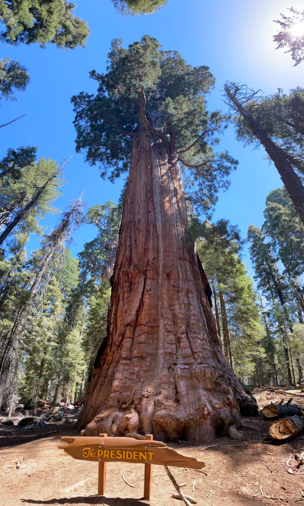
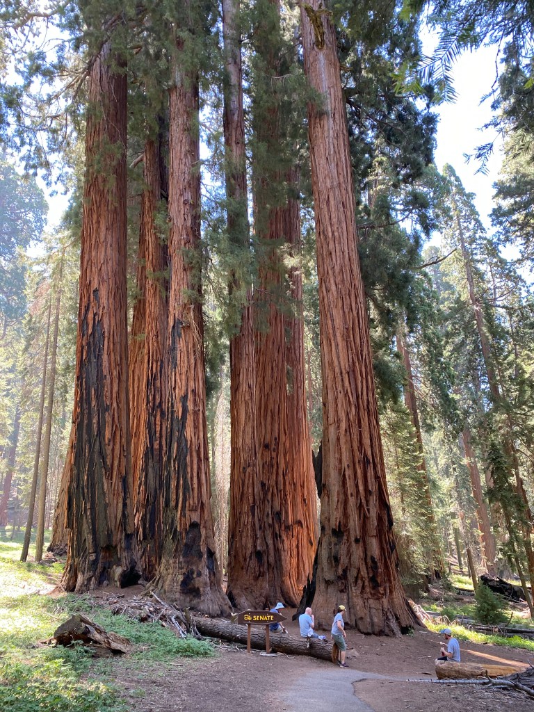
It was a short downhill walk to Sherman and relatively crowded so seeking some solitude amongst the Giants I continued on the Congress Trail which featured aptly named trees such as the President, McKinley, The Senate, etc. Many showed burn scars from long ago fires. Tragic to my eyes but a necessity for sequoias to release their seeds and regenerate.
The additional 4 miles of this walk, + the steep incline wearing a mask(!), and the 7000’ elevation pooped me out. I guess it was fortunate then I had a good long sit in the car on the way up to Kings Canyon National Park due to a long delay for road reconstruction. A nice ranger cautioned me that further on the road was shut completely for about 3 hours and if I wanted to continue north I’d have to go via Hume Lake. Hume Lake is a little village a little east of where I was planning to go but it had a village market selling ice cream so I easily reconciled myself with the change of plans!
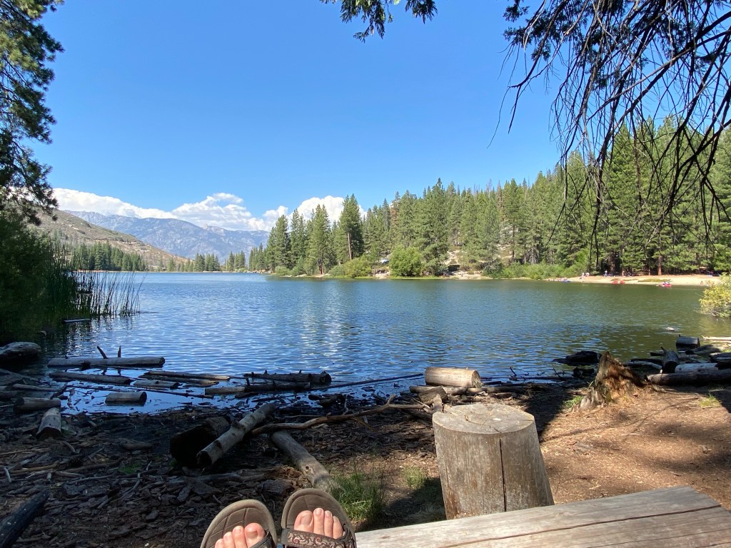
Being a village with lots of services located on a scenic lake, Hume also featured a lot of tourists. I scooted back out of town as soon as my ice cream was finished and found a quiet little private cove all for myself and relaxed a while enjoying the view and last Saturday’s crossword.
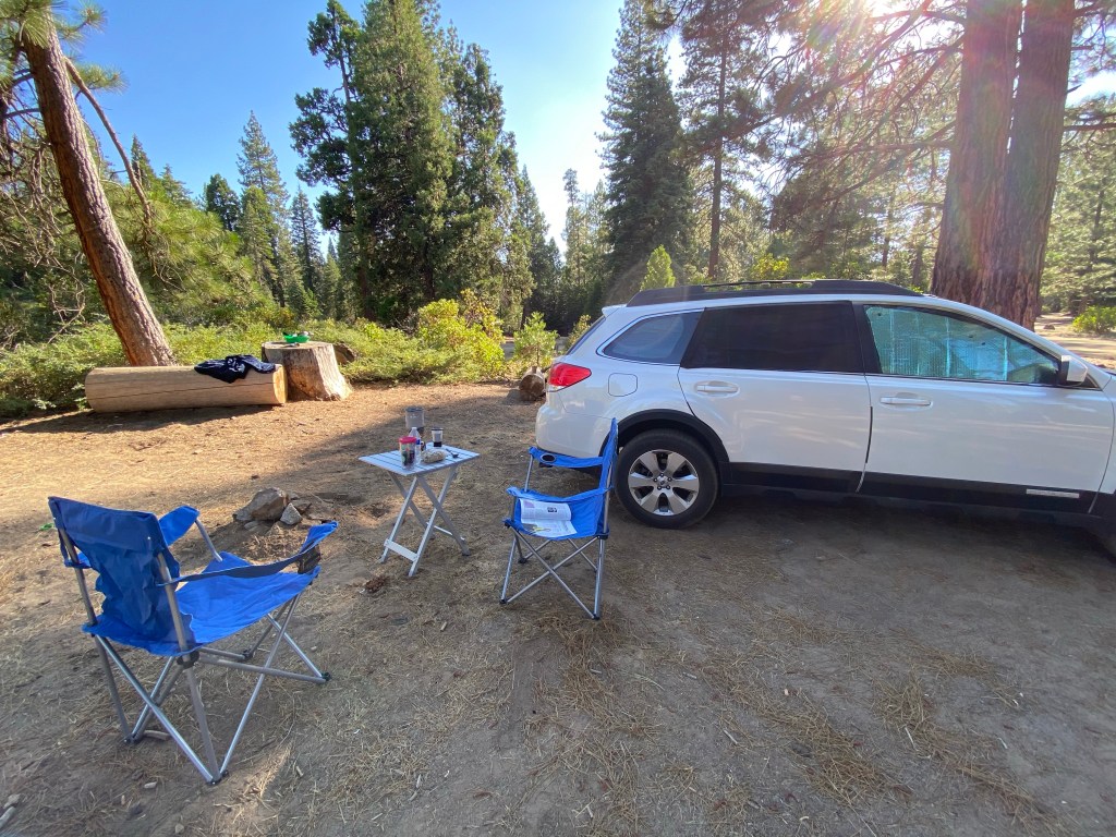
By 4pm the lake-goers were packing up so I figured I’d better start looking for a place to camp for the night. The first place I tried was a proper campground and chocker block full of people, so I continued on up the hill and took the next Forest Service road I came to.
Here in the Sierra National Forest one is allowed to camp anywhere unless it is signed to the contrary and this road was a proper dispersed camping area with large open sites and (un)official fire rings. I found myself a good spot and set up for the night. You won’t see the full Subaru Setup here as 1. I didn’t need to set up my shade structure, and 2. as my first night I still need to work out the kinks but here’s a pic of the site:
BTW: dinner was a delicious rehydrated Beef Stroganoff served al fresco. And an early turn in for this tourist/hiker/camper as I’m bushed!
Tomorrow: Kings Canyon National Park
