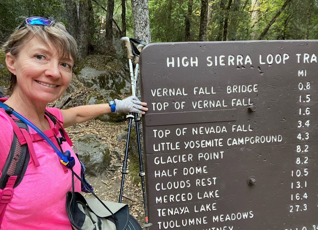
Today is the day I’ve been looking forward to / dreading! I’m going to test my physical fitness by hiking the Mist Trail. It’s basically a vertical stair stepper for 3400’, have a look at a waterfall, then turn around and go back down. I think I’m ready – we’ll see!
Because it’s been so hot I set my alarm for 5:15am and was on the road at 5:20am. I had packed up everything last night, slept in my clothes, and went without my morning coffee. Let’s hit it!
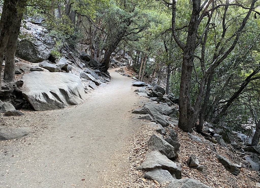
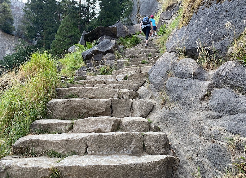
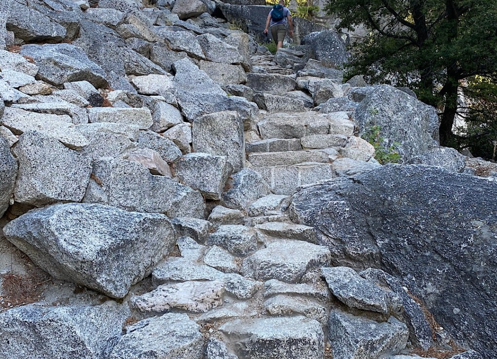
I parked in the Curry Village day lot and at 6:30am was starting the mile+ walk to the trailhead. The sun was just entering the valley but fortunately the trail was so well shaded I rarely felt it’s heat. The trail however, had my generating my own little internal steam engine. The first mile is paved but is calf-burning steep, with little dips to catch your breath before you climb again. Then the fun starts. Stairs, hundreds and hundreds of stairs. Big stairs, high stairs, narrow stairs, tiny stairs, slippery stairs.
Then you see the Vernal Falls and you think, maybe all this is really worth while….
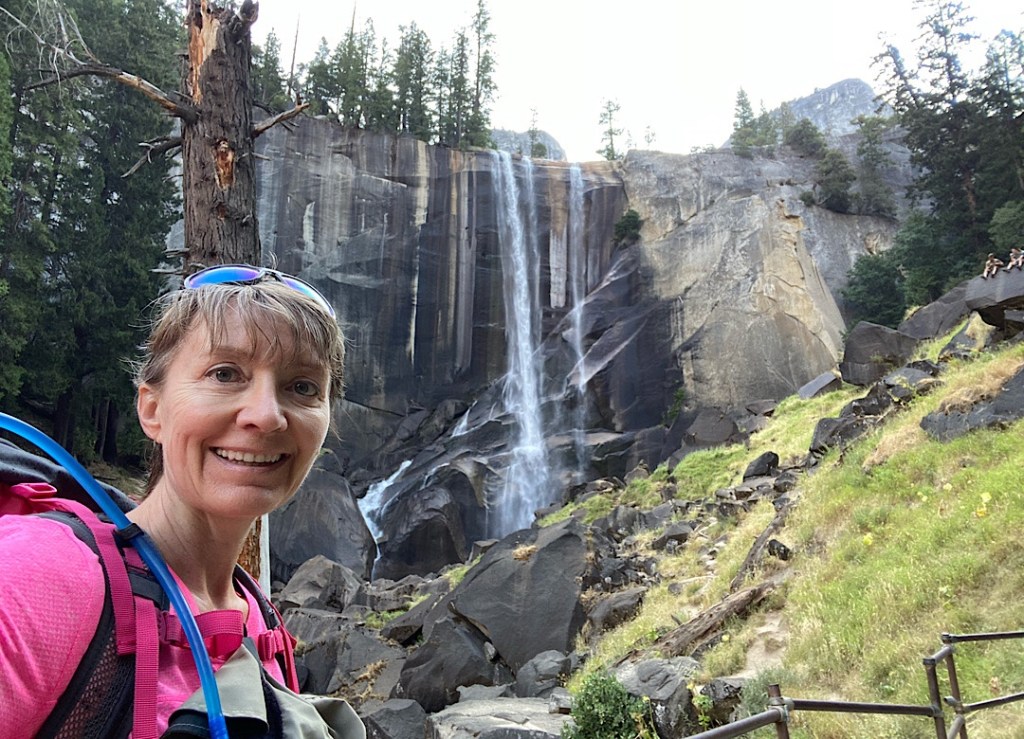
There wasn’t even the slightest whisper of a mist to cool us down; instead your senses were filled with the pounding of the narrow stream of water hitting the rocks below, like a power washer blasting away at concrete. There wasn’t too much time available to wonder at the beauty of the spectacle as one feels the pressure to maintain their place in the line of hikers trudging up. Stepping aside means donning a mask, and catching one’s breath was hard enough unmasked!

For some reason you feel you’ve made it once you’re face-to-face with the falls but when you turn the corner you find yourself facing 100’s of more bloody stairs! Urgh!
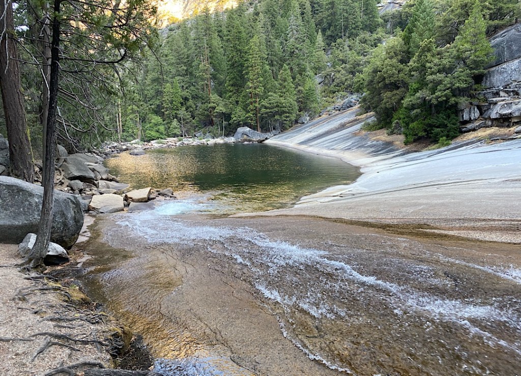
Finally at the top of Vernal Falls your jelly-like legs have a breather as the path levels out to lead you through a beautiful oasis consisting of the falls, the aptly named Emerald Lake that feeds it, the gentle cascades that fill the lake, and a little wooden bridge that crosses you over from heaven back to stair hell.
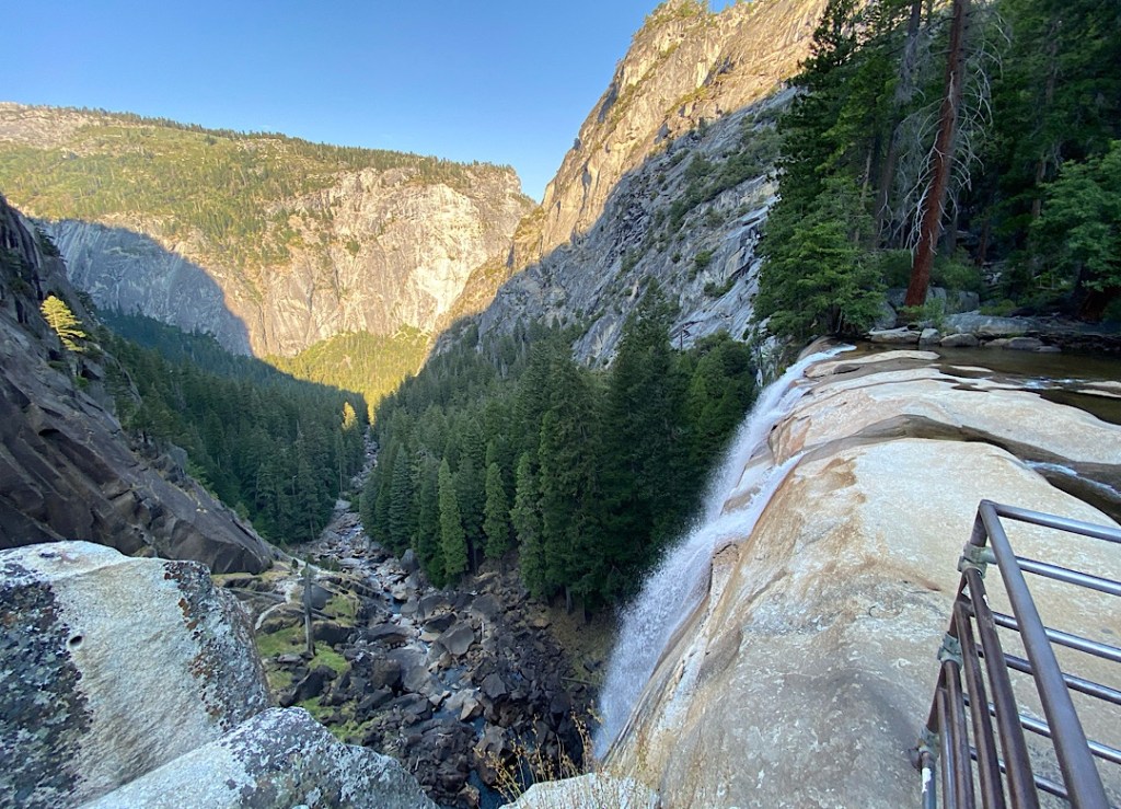
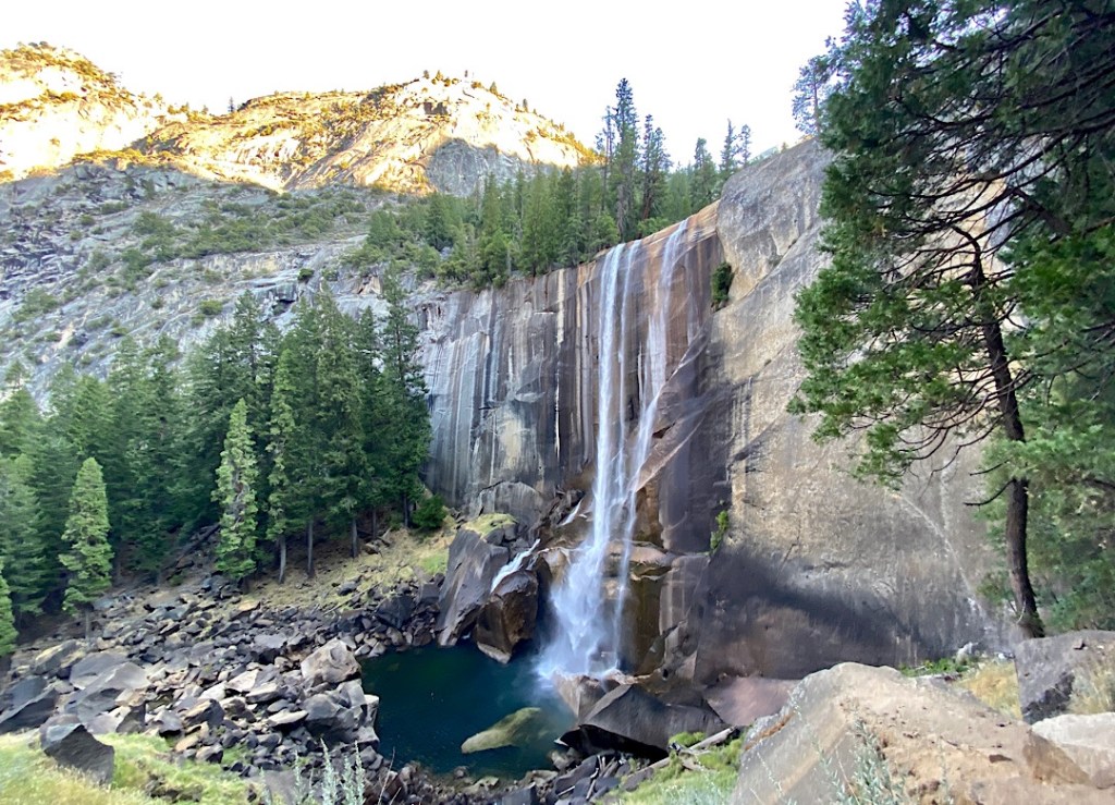
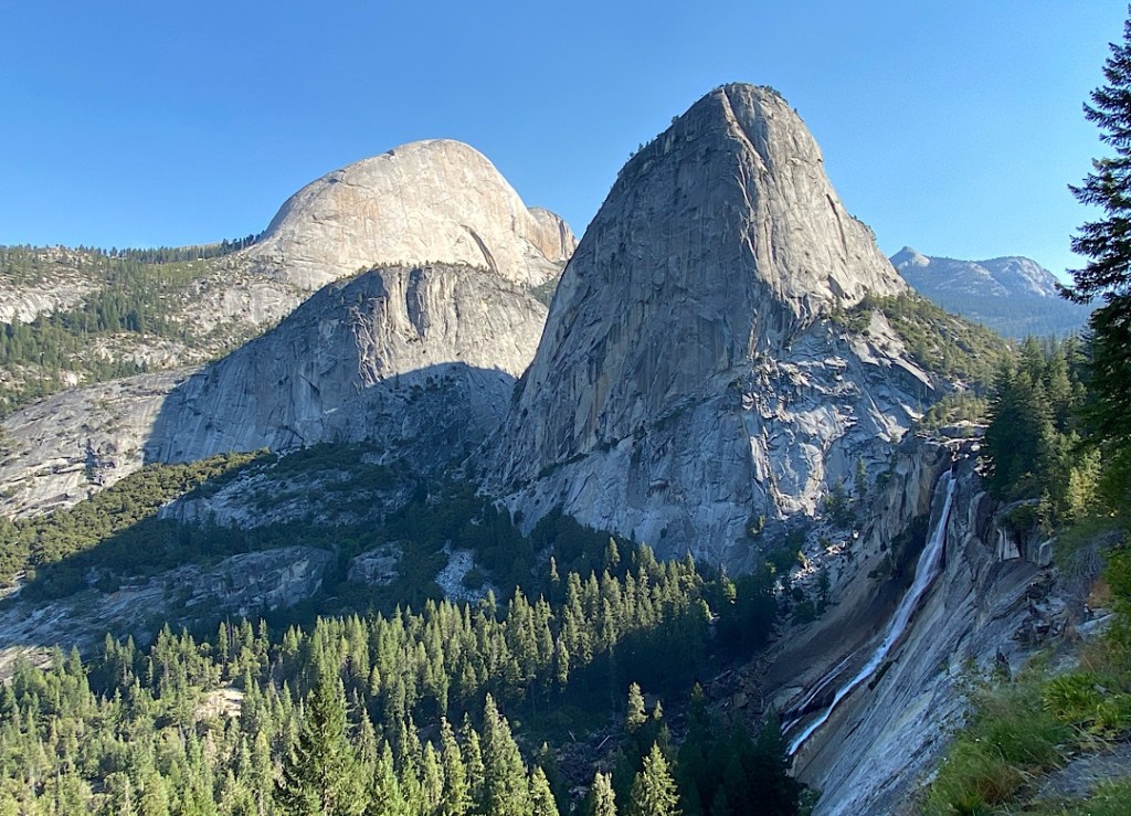
1.2 further miles of some trail but mostly tiny, slippery, slope-y stairs to the top of Nevada Falls. This was the shot I was missing on Friday when I hiked the Panorama Trail: to see the scale of the strength and height of the Falls.
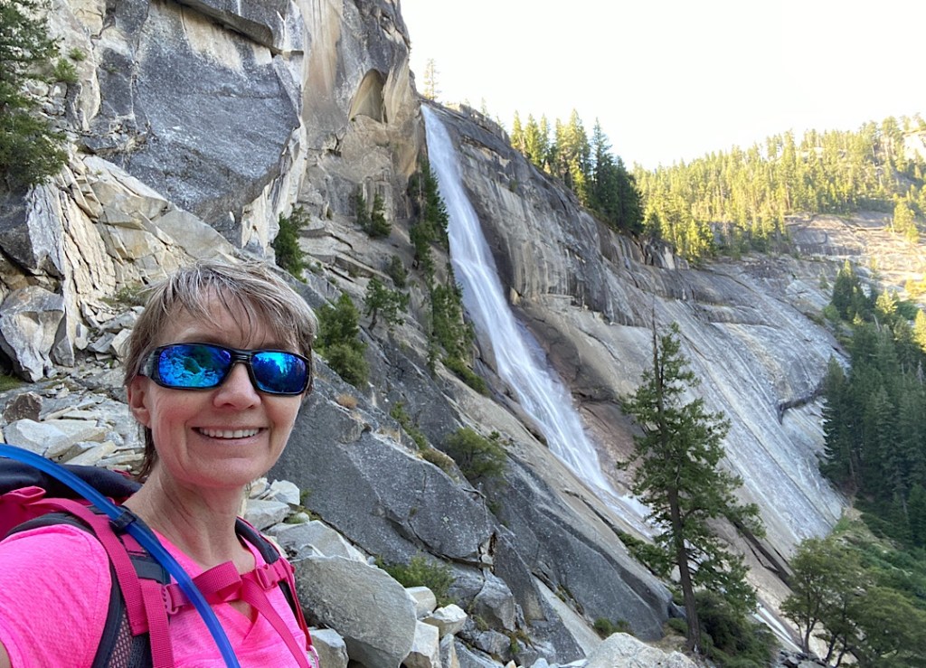
At exactly 2 hours from starting my hike I crested out at the bridge of Nevada Falls. It was surprisingly peaceful, with only 2-3 other hikers. Where did everyone go? Perhaps they all had permits to continue on to Half Dome. Anyway, after a quick donut (power food!) I continued on to descend on the John Muir Trail to make a loop back to the trailhead.
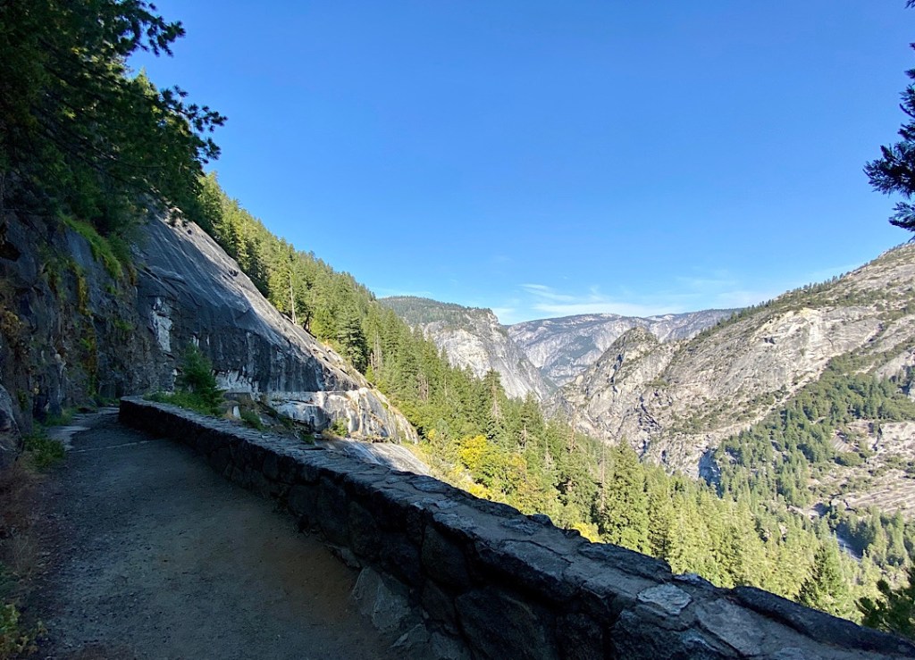
Since Covid they’ve instituted a one-way system between 9am – 4pm of going up the Mist Trail and down the John Muir Trail. Not only does this present less face-to-face interactions, it really eases congestion on the extremely popular and dangerously narrow and steep Mist trail. And the JMT is an excellent, wide, weirdly semi-paved, more gently descending trail.
I only saw 4 hikers on my descent, 3 JMT-ers heading up (they’re allowed to go up & down) and one young man sitting still, felled by muscle cramps on his way down. I had nothing to give him but trail mix, hopefully another hiker will have some gels or salt tablets to help his condition. I offered to call for help for him but he was going to wait it out.
Like salmon swimming upstream I met a constant flow of people of all shapes, sizes, and ages coming against me once the JMT merged back with the Mist trail. It’s almost 11am and I’m sweating going down hill. I hope everyone will be okay and they don’t try to go the whole way up….
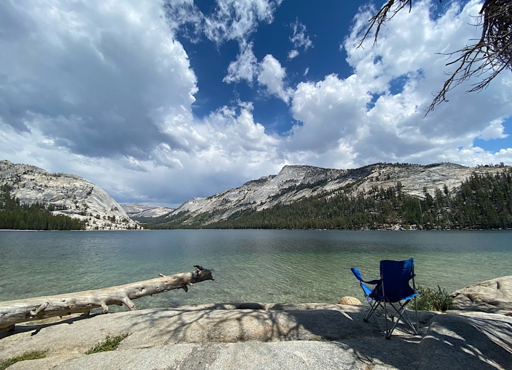
10 miles total hiking back to my car and it’s hot. Time to get out of the Valley. I forwent my planned swim in the Merced river to instead head up in elevation to drive the Tioga Pass Road eastward, stopping at all the turnouts to check out all of the views and all of the information boards.

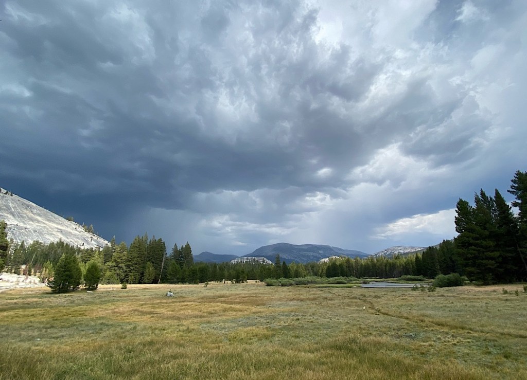
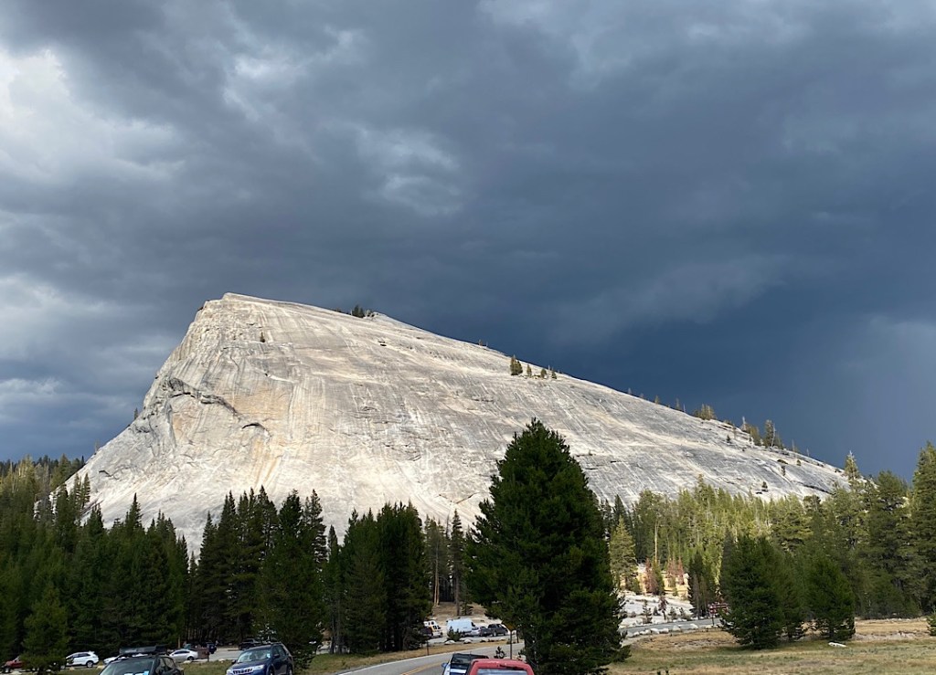
The skies started to darken threateningly during my swim so I reluctantly cut my relaxation short to head out to find my evening’s campsite before it got too late. By the time I reached Toulumne Meadows the thunder & lightning started and the rain started falling. It was grey, cold (54°F), and only looked to get worse. I attempted to find a spot at 2 different campgrounds but both were full and with conditions hardly conducive to being outside I just continued driving on east down the forbidding, barren, precipitous route to Lee Vining.
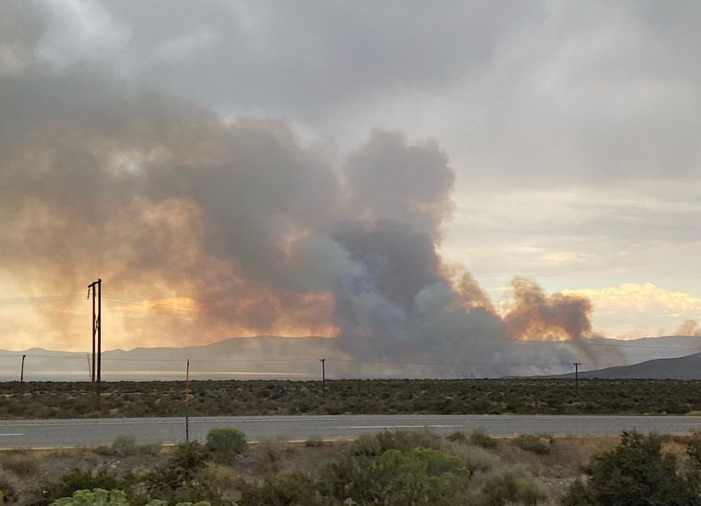
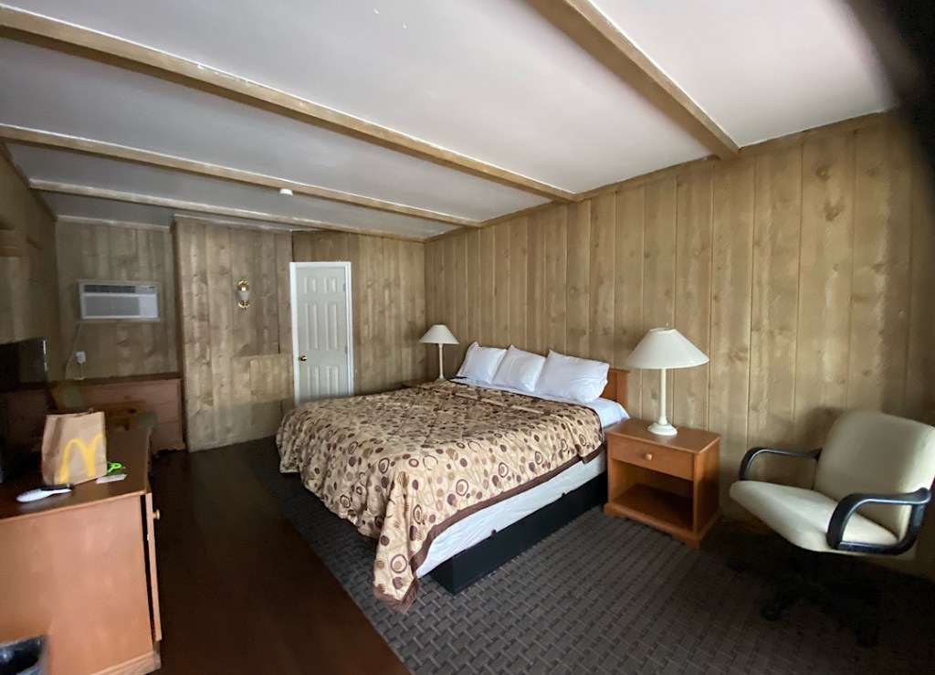
Once there I was facing the billowing black clouds of a forest fire just across the road on the shores of Mono Lake. Thunder! Lightning! Fire! Get me outta here!! I kept driving south until I reached Bishop. 93° = el cheapo hotel. I booked into the Townhouse Motel. Dated in a kitschy way but clean and I can now have my first real shower in a week! I’m happy.
Tomorrow = home.
